
Border
Create Site Border command added under Tools menu.
Convert Shape to Site Line
If the source shape for the Convert Shape to Site Line command is a polygon the Site Line will be created as a polygon.
The new Site polygon can be exploded to separate shapes if required.
Edit
If a Site object is made visible in Drawing Mode it can be edited in Drawing Mode.
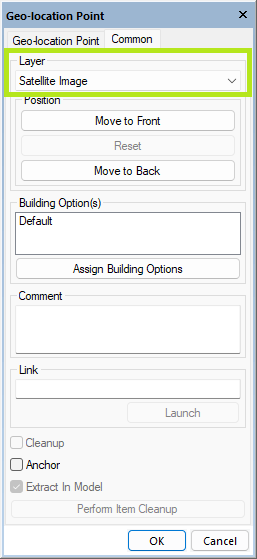
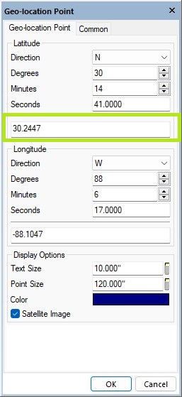
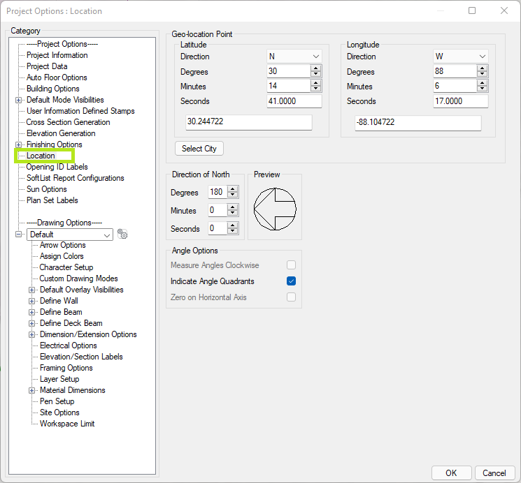
Geo-location Point
Default color configuration added to Geo-location Point.
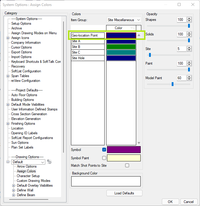
Layer option added to Geo-Location Point.
Latitude and Longitude data for Geo-location points can be entered in decimal degrees in addition to degrees/minutes/seconds.
This simplifies imports from mapping applications like Bing and Google Maps.
Image
Adjust Size command in Site Mode allows Distance input.
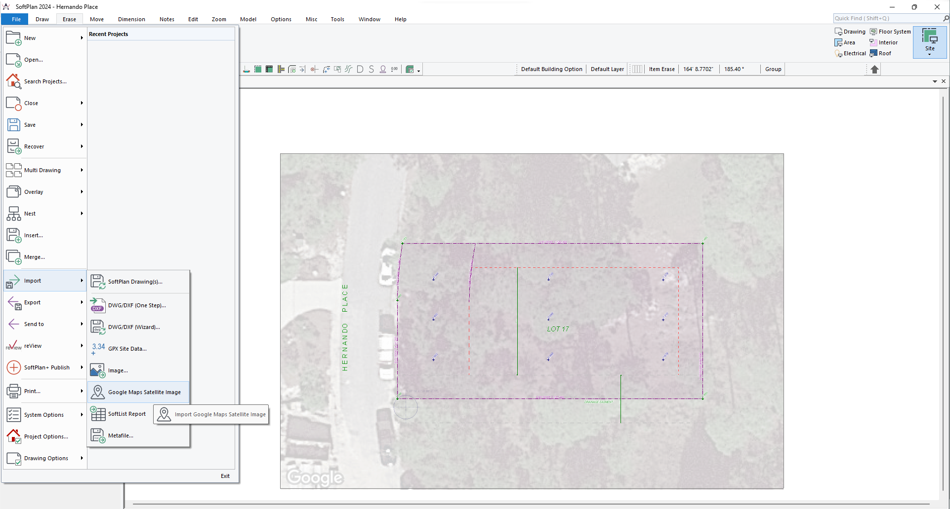
Import
Google Maps Satellite Image added.
This feature is only available to SoftPlan and SoftPlan+ subscribers.
Location
Project Option: North Options renamed to Location and includes Geo-location Point Latitude and Longitude.
Move
When moving an Image the vectors are visible through the image making it easier to align items.
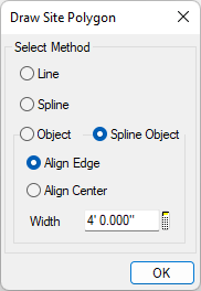
Polygon
The Form Polygon command does not change the shapes when combining a spline with a regular orthographic shape.
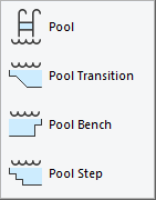
Pool
Pool commands added.
Repeat Edit
Arc Length added to Repeat Edit.
Arc Radius added to Repeat Edit.
Section Lines
Site Plans no longer display Section Lines by default.
Section Lines can be made visible in Site Plans via the Visible Items.
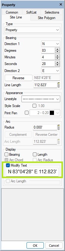
Site Lines
Arc Length added to Display and Print of radiused Site Lines.
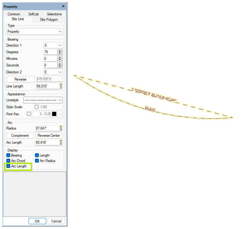
Modify Text option added to Edit of a Site Line.
Useful when the survey provided does not completely form a closed polygon.
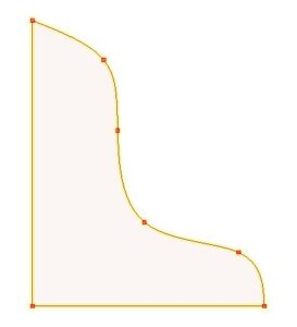
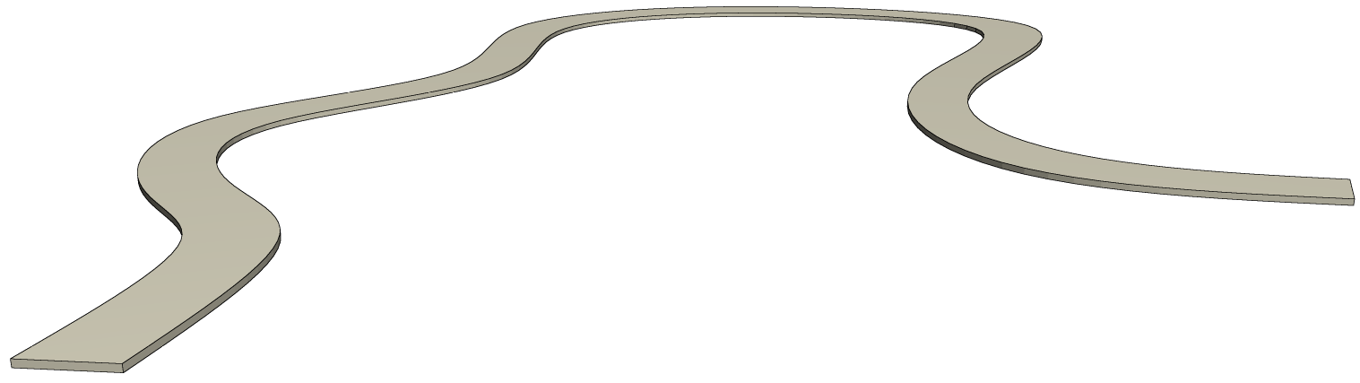
Spline
Site work can be drawn as spline.
Toolbar
Location Options added to the default Site Mode toolbar.
